How to price drone real estate photography
Using drone photography for real estate listings is a smart move. It makes properties look way better and can even help them sell faster. But when you’re looking into drone real estate photography pricing, it can get a little confusing. There are a bunch of things that go into the cost, from how experienced the photographer is to what kind of shots you want. Let’s break down what you need to know so you can figure out the right price for your needs.
Key Takeaways
- Drone photography gives buyers a bird’s-eye view, making listings more interesting and potentially speeding up sales.
- Costs for drone real estate photography depend on things like the photographer’s skill level, the size of the property, and where it’s located.
- You can find different pricing structures, like paying a set fee for a package, an hourly rate, or a price based on the property’s square footage.
- Things like the quality of the drone equipment, how many photos or videos you get, and whether special permits or insurance are needed can also change the price.
- Being clear about what’s included in the price and showing the benefits of aerial shots helps clients understand the value.
Understanding Drone Real Estate Pricing Factors
When you’re figuring out how much to charge for drone real estate photography, it’s not just a simple number. A bunch of things play into the final price, and knowing these can help you set your rates fairly and help clients understand what they’re paying for. It’s like baking a cake; you need the right ingredients in the right amounts to get a good result.
Photographer Experience Levels and Associated Costs
Just like any profession, the more experienced a drone photographer is, the more they’ll likely charge. A beginner might be learning the ropes, experimenting with angles, and still getting a feel for the equipment. They might charge less to build their portfolio and gain clients. An intermediate photographer has a solid grasp of techniques and has likely worked on a good number of properties. They can deliver consistent results and probably have a decent portfolio. Then you have the pros – these are the folks who have been doing this for years, have a polished style, and can handle almost any situation. Their rates reflect their skill, reliability, and the quality they consistently produce.
- Beginner: Typically charges between $75 – $150 per property.
- Intermediate: Rates usually fall between $150 – $300 per property.
- Professional: Expect to pay $300 – $500 or more per property.
Property Size Impact on Aerial Photography Fees
The sheer size of the property you’re shooting makes a big difference. A small condo with a tiny yard is a much quicker job than a sprawling estate with acres of land. More land means the drone has to fly further, cover more ground, and potentially take more shots to capture everything effectively. This also means more time spent on location and more time in post-production editing.
- Small Properties (under 1,000 sq. ft.): Often priced from $75 – $150.
- Medium Properties (1,000 – 3,000 sq. ft.): Fees usually range from $150 – $350.
- Large Properties (over 3,000 sq. ft.): Can start at $350 and go up from there.
Geographic Location and Its Influence on Pricing
Where you are matters. In a busy city with high demand and lots of competition, prices might be higher. Real estate is often more expensive in these areas, so photographers can charge more. On the flip side, if you’re out in a more rural area, you might find lower prices. There could be less demand, fewer photographers, or just a different cost of living that affects rates. Travel time to more remote locations can also add to the cost.
The cost of living and the general market rates for services in a specific area are strong indicators of what you can expect to pay for drone photography. High-demand urban centers often command higher prices compared to less populated rural regions.
Service Inclusions: Photos Versus Video Packages
Are you just looking for a few good aerial photos, or do you need a full video tour? This is a major factor. Photos are one thing, but shooting and editing video takes significantly more time and skill. A basic package might include a handful of edited aerial shots. A more advanced package could include a cinematic video walkthrough, complete with smooth camera movements and maybe even some background music. The more you want, the more it’s going to cost.
- Basic Photo Package: A set of high-resolution aerial images.
- Photo & Video Combo: Includes aerial photos plus a short video clip (e.g., 30 seconds to 2 minutes).
- Premium Package: More extensive photo library and longer, more polished video content (e.g., 1-3 minutes).
Key Elements Affecting Drone Photography Costs
When you’re looking into drone photography for your property, a few things really bump the price up or down. It’s not just about pointing a camera at a house from the sky; there’s some serious tech and skill involved. Understanding these pieces helps you figure out why one quote might be way different from another.
Drone Equipment Quality and Its Price Correlation
The drone itself and the camera it carries make a big difference. Think of it like buying a car – a basic model gets you from A to B, but a high-end one offers a smoother ride and better features. Professional drone photographers often invest in top-tier equipment. These aren’t your hobbyist drones; they’re built for stability, have advanced sensors, and carry cameras capable of capturing incredibly sharp, detailed images and smooth video. This superior gear allows for better shots, especially in tricky lighting or windy conditions, and that quality comes at a cost. Cheaper drones might get the job done for a quick snap, but for real estate marketing where every detail matters, the investment in better equipment is usually reflected in the photographer’s rates.
Volume of Content: Photos and Video Duration
This one’s pretty straightforward: the more you want, the more you pay. If you’re just looking for a handful of aerial shots to show the property’s layout, that’s one thing. But if you want a dozen high-resolution photos, plus a few minutes of smooth, edited video footage showcasing the home from various angles and altitudes, it takes significantly more time. Capturing the footage is only part of it; editing that content to make it look polished and professional adds another layer of work. More photos and longer video clips mean more time spent on-site and more hours at the computer, so expect the price to climb accordingly.
Navigating FAA Regulations and Permit Expenses
Flying drones isn’t just a free-for-all. The Federal Aviation Administration (FAA) has rules, and professional pilots need to follow them. This often means getting a Part 107 certification, which requires passing a test and staying up-to-date. Beyond that, certain areas might have restrictions or require special permits to fly. While the photographer usually handles this, the time and effort involved in understanding and complying with these regulations, and potentially paying for permits, are factored into their pricing. It’s about ensuring the shoot is legal and safe, which is important for everyone involved.
The Role of Professional Liability Insurance
Accidents can happen, even with the most experienced pilots. Professional drone photographers carry liability insurance to protect themselves, their clients, and the public in case something goes wrong – like a drone malfunctioning and causing damage. This insurance isn’t cheap; it’s an ongoing annual expense for the business. Because it’s a necessary cost of doing business professionally, it’s naturally built into the prices they charge for their services. It provides peace of mind and ensures that if the unexpected occurs, there’s a safety net in place. Hiring someone with proper insurance is a sign of a serious, professional operation, and it’s a key part of what you’re paying for when you hire a drone photographer.
Exploring Drone Real Estate Photography Pricing Models
When you’re figuring out how much to charge for drone real estate photography, there isn’t just one way to do it. Different approaches work for different situations and clients. It’s all about finding a structure that makes sense for you and the services you provide. Understanding these models helps both photographers and clients set clear expectations.
Here are some common ways photographers price their aerial services:
Flat Rate Packages for Aerial Services
This is probably the most straightforward method. You set a fixed price for a specific set of deliverables. For example, a package might include 15 high-resolution aerial photos and a 30-second video clip. It’s easy for clients to understand what they’re getting and how much it will cost upfront. This model is great for standard property listings where the scope of work is predictable. You might see packages ranging from $250 for basic photo sets to $500 or more for combined photo and video options.
Hourly Billing for Drone Shoots and Editing
Some photographers prefer to bill by the hour. This can be good for projects that are hard to define upfront or when clients might need a lot of flexibility. You’d charge for the time spent on-site shooting, plus the time spent editing the photos and videos afterward. Rates can vary widely, often falling between $100 and $200 per hour, depending on your experience and equipment. It’s important to give clients a realistic estimate of the total hours you expect the project to take.
Price Per Square Foot for Property Coverage
For larger or more complex properties, pricing based on square footage can be a fair approach. You set a rate per square foot of the property’s total area. This method scales well with property size, meaning larger estates naturally cost more. The rate might be something like $0.10 to $0.25 per square foot. This model works best when you have a clear understanding of the property’s dimensions.
Bundled Package Deals for Comprehensive Services
This is where you combine drone photography with other services to create a more complete marketing package. Think about offering aerial photos, video walkthroughs, twilight shots, or even 2D floor plans all in one deal. Bundles often provide a perceived discount for the client compared to buying each service separately. For instance, a premium package might include everything needed to fully showcase a luxury home, making it an attractive all-in-one solution. You can find great drone options that help create these comprehensive packages.
When choosing a pricing model, consider the complexity of the shoot, the amount of editing required, and the overall value you’re providing to the client. Transparency is key, no matter which model you select.
Additional Factors Influencing Drone Real Estate Pricing
Beyond the basics of property size and service packages, a few other things can nudge the final price of your drone real estate photography up or down. It’s not just about the drone and the camera; it’s about the whole picture, from the sky to your inbox.
Impact of Weather Conditions on Scheduling and Costs
Let’s be honest, nobody wants blurry photos because of rain or wind. Bad weather can really mess with scheduling. If a shoot needs to be postponed, that’s lost time and potentially extra travel costs for the photographer. Sometimes, even if the weather isn’t a complete washout, you might need extra editing to fix harsh shadows or make a gloomy day look a bit brighter. This can add to the bill, so it’s good to have a bit of flexibility in your budget for these situations.
Advanced Editing Requirements and Their Fees
What you see in a finished real estate listing isn’t always straight out of the camera. Editing is a big part of making those aerial shots pop. Basic edits like color correction and cropping are usually included, but if you want more, like removing unwanted objects, adding sky replacements, or even creating 3D virtual tours from the footage, that’s going to cost extra. The more complex the editing, the more time the editor spends, and that time is money.
Here’s a rough idea of how editing costs can stack up:
| Editing Type | Estimated Cost per Image |
|---|---|
| Basic Color Correction | Included |
| Object Removal | $15 – $50 |
| Sky Replacement | $20 – $75 |
| HDR Blending | $10 – $30 |
Turnaround Time Expectations and Expedited Service Charges
When you’re selling a house, speed often matters. If you need those drone photos back yesterday, most photographers can offer expedited services. This usually comes with a rush fee because it means they have to drop other work or stay up late to get your project done. It’s a trade-off: pay a bit more for faster delivery or wait a standard amount of time.
Licensing and Certifications for Professional Pilots
Not just anyone can fly a drone commercially. Professional drone pilots need to be certified by the FAA (that’s the Federal Aviation Administration). This certification, often called a Part 107 license, shows they know the rules of the sky. Pilots who have this certification and keep up with ongoing training often charge a bit more. It’s a sign of their professionalism and commitment to flying safely and legally, which is a big deal when you’re dealing with property. You can find certified pilots through various aviation resources.
Hiring a certified pilot means you’re working with someone who understands airspace regulations and safety protocols. This reduces risk for everyone involved and often results in higher quality, more compliant aerial media for your property listing.
Communicating Your Drone Real Estate Pricing Effectively
When you’re talking to clients about drone photography prices, being clear is super important. It helps them understand what they’re paying for and builds trust. Think of it like explaining why a certain tool is better for a job – you show them the results.
Transparency in Cost Breakdown and Service Details
Nobody likes hidden fees, right? So, lay it all out. What exactly are they getting for their money? Break down the costs so it’s easy to follow. This means listing out:
- Number of edited photos: How many high-resolution aerial shots will they receive?
- Video length and editing: If video is included, what’s the approximate duration, and what kind of editing is done (color correction, basic cuts)?
- Travel fees: Are you charging extra if the property is far away?
- Turnaround time: When can they expect the final files?
Being upfront about every single charge prevents confusion later on.
Highlighting the Value Proposition of Aerial Imagery
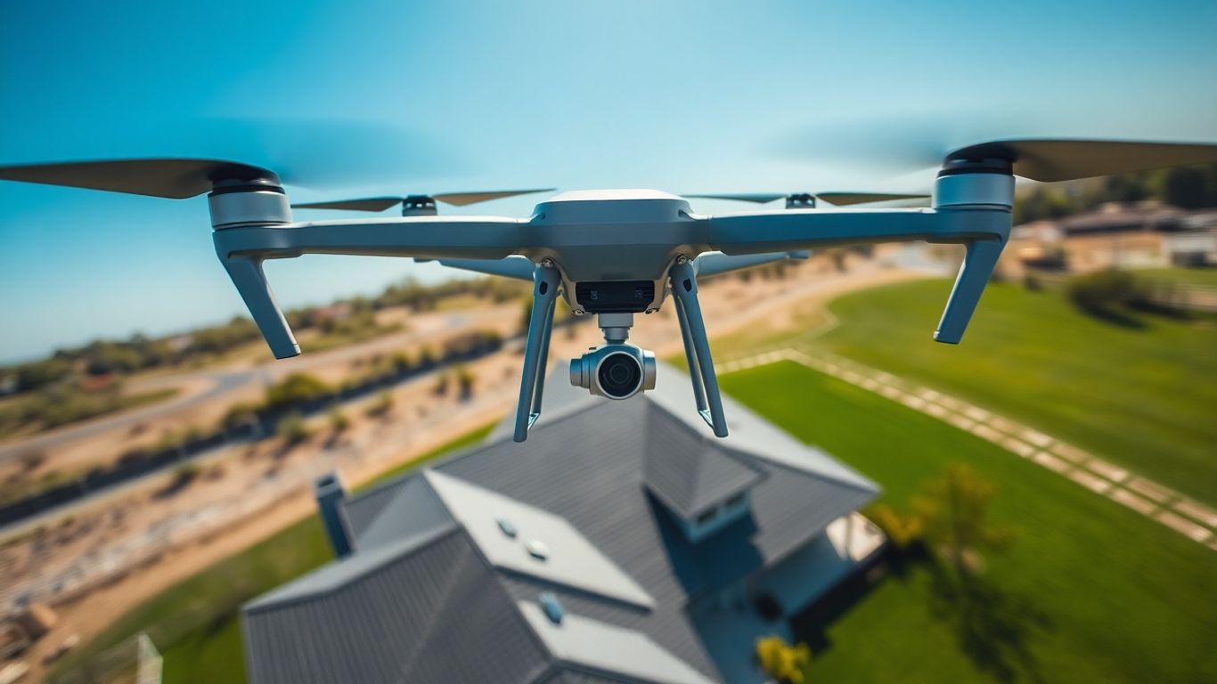
It’s not just about pretty pictures; it’s about selling houses faster and for more money. Explain that drone shots give potential buyers a bird’s-eye view, showing off the property’s size, layout, and its place in the neighborhood. This kind of perspective is something regular ground photos just can’t match. Think about it: buyers get a feel for the whole lot, the roof condition, and nearby amenities all at once. This can make a listing way more appealing.
Offering Customizable Service Options
Not every client needs the same thing. Some might just want a few aerial shots, while others want a full video tour. Offering different packages lets clients pick what fits their budget and needs best. You could have a basic package with a set number of photos, a mid-tier option that adds video, and a premium package for larger properties or more extensive editing.
Here’s a quick look at how packages might stack up:
| Package Name | Photos Included | Video Included | Price Range |
|---|---|---|---|
| Basic Aerial | 10-15 | No | $150 – $250 |
| Photo & Video | 20-25 | 30-60 seconds | $250 – $400 |
| Premium Showcase | 30+ | 1-2 minutes | $400 – $600+ |
Utilizing Visual Aids to Justify Pricing
Show, don’t just tell. Use examples of your past work to demonstrate the quality and impact of your drone photography. Displaying a few before-and-after comparisons or showcasing a property that sold quickly after using your aerial shots can really help clients see the benefit. A portfolio with stunning aerial photos and engaging video clips speaks volumes and makes your pricing seem much more reasonable when they see the quality they’re getting.
Clients are more likely to invest in your services when they can clearly see the tangible benefits and the professional quality you bring to the table. It’s about showing them the return on their investment through better property marketing.
Real-World Drone Real Estate Pricing Examples
So, you’re wondering what this whole drone photography thing actually costs for real estate? It’s not a one-size-fits-all answer, but we can look at some typical numbers to give you a better idea. Prices can really swing depending on what you need.
Let’s break it down into a few common scenarios:
- Basic Aerial Photo Packages: If you just need a handful of good aerial shots to show off the property’s layout and its place in the neighborhood, you’re probably looking at something in the ballpark of $200 to $300. This usually gets you about 8 to 15 edited photos. It’s a solid starting point for many listings.
- Comprehensive Photo and Video Services: Want more than just stills? Adding video footage, even a short clip, will bump up the price. For a package that includes a decent number of photos (say, 15-25) and a 1-3 minute edited video, you might expect to pay anywhere from $350 to $700. This gives buyers a much more dynamic feel for the property.
- Large Properties and Premium Packages: For sprawling estates, commercial properties, or if you need extensive video coverage and advanced editing, the costs go up. We’re talking $500 and well beyond, potentially reaching $1,000 or more for very large or complex projects. This often includes more detailed editing and longer video durations.
Here’s a rough idea of what you might see:
| Service Type | Typical Price Range | What’s Included (Example) |
|---|---|---|
| Basic Aerial Photos | $200 – $300 | 8-15 edited photos |
| Photos + Short Video | $350 – $500 | 15-25 edited photos, 30-second to 2-minute video |
| Photos + Extended Video | $500 – $800 | 15-25 edited photos, 1-3 minute edited video |
| Large Property / Premium Package | $600+ | Extensive photos/video, advanced editing, longer flight times |
Remember, these are just general figures. Things like the photographer’s experience, your specific location, and any special requests can shift these numbers. It’s always best to get a detailed quote for your particular needs. You can find providers who offer basic drone shots for around $200, which is a good starting point for many agents. See pricing examples.
The cost of drone photography can seem like a lot upfront, but think about the potential return. Faster sales, higher offers, and listings that really grab attention online can make it a worthwhile investment for showcasing properties effectively. It’s about getting that unique perspective that standard photos just can’t capture.
When you’re looking at prices, don’t forget to ask what’s included. Sometimes a lower price might mean less editing or fewer shots. Understanding the full scope of services will help you make the best choice for your listing.
Wrapping It Up
So, figuring out drone photography prices can seem a bit much at first, right? You’ve got the photographer’s skill level, how big the place is, whether you want video too, and even where it’s located. It’s not just a simple number. But remember, good aerial shots really make a property pop and can help it sell faster. Think about what you need most – maybe just a few cool photos, or a whole package with video and editing. By looking at what different photographers offer and what fits your budget, you can find the right fit. It’s about getting those amazing views that show off the property best, and that’s worth putting some thought into.
Frequently Asked Questions
What exactly is drone real estate photography?
Drone real estate photography is basically taking pictures and videos of a house or property from high up in the sky using a drone. It gives you a cool, bird’s-eye view that you just can’t get with a regular camera on the ground. This helps listings look way more interesting and can make them sell faster.
How much does drone photography usually cost for a house?
The price can change a lot, but you’re often looking at somewhere between $150 and $600. It depends on things like how big the property is, where it’s located, and how much experience the photographer has. Simple photo packages might be cheaper, while ones with video and lots of editing will cost more.
What makes the price of drone photos go up or down?
A few things affect the cost. If the property is really big, it’ll cost more. If you want lots of photos or a long video, that adds to the price too. Also, if the photographer is super experienced or uses really fancy equipment, they might charge more. Sometimes, if you need the photos back really quickly, that can also cost extra.
Is it more expensive to get drone video too?
Yes, usually it is. Getting just aerial photos is one price, but adding video footage, especially if you want it edited nicely, will generally increase the total cost. It takes more time and skill to capture and put together good drone videos.
Do I need to worry about any special rules or permits for drone photography?
Yes, drone pilots need to follow rules set by the government (like the FAA in the US). Sometimes, especially in certain areas, they might need special permission or permits to fly. This can sometimes add a little bit to the overall cost because it takes extra effort to make sure everything is legal.
Why should I pay for drone photography instead of just regular photos?
Drone photos make listings way more eye-catching. They show off the whole property, including the yard and the neighborhood, which buyers love. Studies show that homes with drone photos sell faster and often get better offers. It’s like giving potential buyers a complete picture before they even visit.