Best drones for mapping and surveying
Drones have really changed how we do mapping and surveying lately. They make getting detailed information way faster and more accurate than before. With good cameras and sensors, these flying gadgets let you capture all sorts of data from above, which is super handy for everything from planning cities to checking on farms. Picking the right one matters a lot, though. You need to think about how long it flies, what it can carry, and how good its camera is. Let’s look at some of the best options out there for drone mapping.
Key Takeaways
- The DJI Matrice 350 RTK is a top pick for drone mapping, known for its precision RTK tech and long flight time, making it great for tough jobs.
- For highly detailed photogrammetry, the WingtraOne Gen II is a strong contender, offering excellent image quality with its 61MP camera and efficient flight.
- The DJI Phantom 4 RTK provides a more accessible yet accurate solution for drone mapping, delivering centimeter-level precision for various projects.
- When high-resolution imagery is a must, the Freefly Astro, an American-made option, uses a 61MP camera for specialized photogrammetry tasks.
- The JOUAV CW-15 is highlighted as a great choice for large area mapping, especially if LiDAR capabilities are needed.
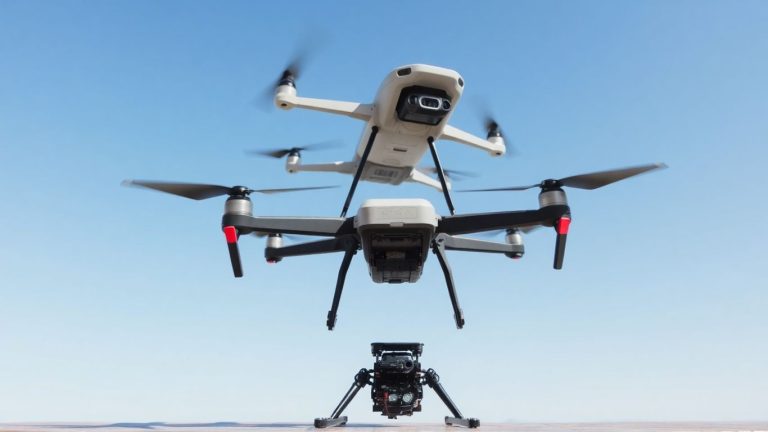
1. DJI Matrice 350 RTK
Alright, let’s talk about the DJI Matrice 350 RTK. This drone is a real workhorse for anyone serious about mapping and surveying. It’s built tough, which is a big plus when you’re out in the field, and it can handle some pretty rough conditions. One of its standout features is the extended flight time, clocking in at a maximum of 55 minutes. That means you can cover a lot more ground without having to constantly swap out batteries, which is a huge time saver on big projects.
When it comes to accuracy, the RTK technology on board is no joke. It gives you that centimeter-level precision you need for detailed mapping. Plus, it’s designed to work with a variety of payloads, including the Zenmuse P1 camera, which is fantastic for photogrammetry. This setup allows for efficient data capture without needing ground control points, which simplifies the whole surveying process.
Here’s a quick look at some of its key strengths:
- Extended Flight Time: Up to 55 minutes allows for extensive area coverage.
- RTK Precision: Delivers centimeter-level accuracy for detailed mapping.
- Payload Versatility: Compatible with various Zenmuse payloads, including the P1 camera.
- Rugged Design: Built to withstand challenging environmental conditions.
- Advanced Obstacle Sensing: Six-direction sensing for safer flights.
The Matrice 350 RTK is a solid choice for professionals who need reliability and precision. Its ability to handle demanding missions and integrate with high-accuracy sensors makes it a top contender for serious mapping tasks. It’s not the cheapest drone out there, but for the performance you get, it’s definitely worth considering if your work demands this level of capability.
It’s also worth noting its compatibility with LiDAR sensors, which can really open up possibilities for different types of data collection. If you’re looking into how drones perform in LiDAR data acquisition for surveying, this is a model that comes up often. The whole system, from the drone itself to the software like DJI Terra, is geared towards making complex surveying tasks more manageable. You can find more details on comparing its LiDAR efficiency with other models if you’re interested in that specific aspect of drone surveying.
2. WingtraOne Gen II
The WingtraOne Gen II is a pretty impressive drone if you’re looking to map large areas without a ton of hassle. It’s a VTOL (Vertical Take-Off and Landing) type, which means it can lift straight up and then transition into forward flight, kind of like a plane. This makes it super handy for getting airborne even when you don’t have a big runway.
What really sets it apart is its ability to cover a lot of ground. It can fly for up to 59 minutes, which is a good chunk of time for getting detailed data over, say, 400 hectares if you’re aiming for 3cm per pixel resolution. It uses a Sony 61MP camera, so the images it captures are really sharp and clear, which is obviously important for accurate mapping.
Here’s a quick look at some of its specs:
- Flight Time: Up to 59 minutes
- Coverage: Around 400 hectares (at 3cm/px resolution)
- Camera: Sony 61MP RGB
- Accuracy: PPK & RTK capable
- Payload Capacity: 0.8 kg
It’s designed to be pretty user-friendly, too. The idea is you can get it up and running quickly. It’s not the cheapest option out there, and it doesn’t have a LiDAR sensor, which might be a dealbreaker for some specific jobs. But for general photogrammetry and mapping, it’s a solid performer that balances efficiency with good image quality.
This drone is built for professionals who need to get a lot of mapping done efficiently. It’s not really a beginner’s toy; it’s more of a serious tool for serious work.
3. DJI Phantom 4 RTK
Alright, let’s talk about the DJI Phantom 4 RTK. If you’re just getting into drone mapping or surveying and don’t want to break the bank immediately, this one’s a solid choice. It’s kind of like the dependable workhorse that gets the job done without a fuss.
What really makes it stand out is the built-in RTK module. This little piece of tech gives you positioning data down to the centimeter level in real-time. Think about that – it means your map data is way more accurate right from the start. No more guessing games or having to do a ton of correction work later. This is super important if you’re doing any kind of professional surveying or GIS work where precision really matters.
It’s also pretty flexible with what cameras it can handle. You can hook it up with standard 4K cameras for regular mapping, or even thermal cameras if you need to do inspections or look for things in low visibility. That makes it useful for more than just mapping; you can use it for checking out infrastructure or even in search and rescue scenarios.
Setting it up is pretty straightforward, which is a big plus. You don’t need to be a drone wizard to get it flying and collecting data. The autopilot system is reliable, and it’s got decent obstacle detection to help keep it out of trouble. It’s not the newest kid on the block, but for the price and what it offers, the Phantom 4 RTK is still a really good way to get started with accurate aerial mapping.
Here’s a quick rundown of what makes it tick:
- Real-time centimeter-level positioning: Thanks to the integrated RTK module.
- Versatile camera options: Works with 4K and thermal cameras.
- User-friendly operation: Easy to set up and fly, even for beginners.
- Good obstacle avoidance: Helps keep your drone safe during flights.
While it’s a great entry-level option, remember that its transmission range isn’t as far as some of the higher-end models. You’ll want to plan your flight paths carefully, especially over larger areas, to maintain a good connection. Also, it’s not really built for super harsh weather, so keep an eye on the forecast.
4. Freefly Alta X with RTK
When you need a drone that can really haul some serious gear for mapping, the Freefly Alta X with RTK is a solid contender. It’s built like a tank, and that’s a good thing when you’re strapping on heavier sensors or cameras for detailed 3D mapping and modeling projects. This thing isn’t messing around; it’s designed for professionals who need to get the job done, no questions asked.
One of the standout features is its modular design. This means you can swap out different payloads pretty easily, making it adaptable for whatever your mission throws at you. Whether it’s a specialized mapping camera, a LiDAR scanner, or even something for delivery, the Alta X can handle it. It’s capable of carrying payloads up to 16kg, which is a pretty impressive number.
Here’s a quick look at some of its specs:
- Payload Capacity: Up to 16kg (around 35 pounds)
- Flight Time: Around 50 minutes, which is decent for covering ground.
- Top Speed: Can hit about 137 km/h (85 mph).
- Payload Compatibility: Works with IR cameras, mapping cameras, LiDAR, hyperspectral sensors, and more.
The advanced blade design on the Alta X is a nice touch. It helps cut down on vibrations, which is super important for getting clean data and high-quality footage. Nobody wants shaky, blurry images when they’re trying to map an area accurately.
While it’s a powerhouse, it’s also a bit of a beast, weighing in at around 76.9 pounds. This isn’t a drone you’ll be tossing in a backpack. Also, keep in mind that flight time can drop when you’re carrying heavier loads, and it doesn’t have built-in obstacle avoidance, so you’ll need to be extra mindful of your surroundings. For serious aerial surveying, though, this drone is definitely worth a look, especially if you’re interested in advanced payload systems. It’s a workhorse that can take on some pretty demanding tasks.
5. JOUAV CW-15
When you’re looking at drones for mapping, especially for those really big areas, the JOUAV CW-15 is definitely worth a look. It’s built with LiDAR technology, which is pretty neat for getting super detailed scans. Think of it as having a really precise laser scanner up in the air. This drone is designed to handle large-scale projects, and it does a good job of it.
One of the cool things about the CW-15 is its ability to take off and land vertically. This means you don’t need a huge runway; it can manage in tighter spots, which is handy if you’re working in tricky terrain like forests or near cliffs. Plus, it has a pretty long flight time, up to 180 minutes, so you can cover a lot of ground without needing to swap batteries constantly. It also has RTK and PPK capabilities, which helps with getting very accurate positioning data, down to the centimeter level.
Here’s a quick rundown of some key specs:
- Flight Time: Up to 180 minutes
- Payload Capacity: 3 kg
- Positioning: RTK and PPK for centimeter-level accuracy
- Special Feature: LiDAR sensor for detailed 3D mapping
- Obstacle Avoidance: Yes
The JOUAV CW-15 is a solid choice if your work involves extensive mapping and you need that high level of detail that LiDAR provides. Its long endurance and ability to operate in varied environments make it a versatile tool for professionals in surveying and infrastructure inspection.
It also has a decent payload capacity, meaning you can attach different sensors if needed, and it’s built with a durable carbon fiber frame. This drone is a good option if you’re comparing long-range drones and need something that can handle demanding mapping jobs.
6. JOUAV CW-007
The JOUAV CW-007 is a pretty neat VTOL drone that’s really good for GIS mapping. It comes with this CA103 camera, which is a 61MP full-frame RGB camera. It’s got an illuminated CMOS sensor and a 35mm lens, so the images it captures are really sharp and accurate. This makes it a solid choice if you’re doing surveying, checking out infrastructure, keeping an eye on things for security, or working in agriculture.
What’s cool is that it can get down to 1cm absolute accuracy, which is pretty impressive for mapping. It’s also quite efficient, meaning it can cover a good chunk of ground in just one flight. Setting it up is also a breeze – it’s modular, so you can put it together or take it apart in less than two minutes, no tools needed.
The CW-007 is built tough with a carbon fiber body, so it can handle some rough weather, like light rain or snow, and still fly steady. It also has features that help it avoid obstacles on its own and can even fly itself back if something goes wrong.
Here’s a quick rundown of what makes it stand out:
- High-Quality Imaging: The 61MP CA103 camera captures detailed photos.
- Accuracy: Achieves absolute accuracy down to 1cm, which is great for precise mapping.
- Versatile Use: Works well for surveying, inspections, security, and farming.
- Easy Setup: Modular design means quick, tool-free assembly.
- Smart Flight: Features like obstacle avoidance and auto-return make flying safer.
It’s definitely a strong contender if you need a reliable drone for mapping, though it does come with a higher price tag than some other options. Also, it doesn’t have a LiDAR sensor, so if that’s a must-have for your specific job, you might need to look elsewhere.
7. DJI Mavic 3 Enterprise
The DJI Mavic 3 Enterprise is a pretty neat drone that manages to pack a lot of punch into a relatively small package. It’s a good option if you need something portable but still want decent mapping capabilities without breaking the bank. It’s not the most high-end drone out there, but for many common surveying tasks, it gets the job done.
This drone strikes a good balance between being easy to carry around and having the features needed for professional work.
When it comes to its camera setup, the Mavic 3 Enterprise comes with a 20MP wide camera that has a mechanical shutter. This is important because it helps prevent blurry images, especially when the drone is moving quickly. It also has a tele camera that can zoom in quite a bit, up to 56x magnification, which is handy for getting a closer look at things without having to fly right over them. The battery life is also pretty respectable, giving you around 36 to 42 minutes of flight time, with a maximum of 45 minutes if conditions are just right. This means you can cover a decent amount of ground on a single charge.
Here’s a quick look at some of its key specs:
- Camera: 20MP Wide (4/3 CMOS, Mechanical Shutter), 12MP Tele (up to 56x zoom)
- Max Flight Time: Up to 45 minutes
- Control Range: Up to 15 km (DJI transmission system)
- Obstacle Avoidance: Omnidirectional
- Optional Module: RTK module for centimeter-level accuracy
One of the really good things about the Mavic 3 Enterprise is that you can add an RTK module to it. This gives you much more precise positioning, down to the centimeter level, which is pretty important for accurate mapping. It also has a pretty long control range, up to 15 km, so you can fly it pretty far away and still keep a good signal. Plus, it has DJI’s AirSense system, which warns you if there are other aircraft nearby, adding an extra layer of safety.
While it might not have the absolute highest resolution sensor compared to some of the bigger, more expensive drones, the Mavic 3 Enterprise is a solid choice for many mapping professionals. Its combination of portability, decent camera quality, and the option for RTK accuracy makes it a versatile tool for everyday surveying jobs.
8. Autel EVO II Dual 640T Enterprise
The Autel EVO II Dual 640T Enterprise is a pretty solid choice if you’re looking to get into thermal mapping without breaking the bank. It packs a punch with its dual cameras, one of which is a thermal imager that can capture data up to 640×512 resolution at 30 frames per second. That’s good for spotting temperature differences, which is super useful for things like inspecting buildings for heat loss or checking on agricultural fields.
Beyond the thermal side, it’s got an 8K video camera and a 48MP still camera, so you’re not sacrificing visual detail. Plus, it offers 4x lossless zoom, which is handy for getting a closer look at things without having to fly right on top of them. The drone also boasts a decent 15km video transmission range and can handle up to level 8 winds, making it quite capable in less-than-ideal weather.
For mapping accuracy, it supports an optional RTK module for centimeter-level precision, which is a big deal for survey work. It also has intelligent route planning and obstacle avoidance, which helps keep things safe and efficient during your flights. It’s not the longest flyer, with a flight time around 42 minutes, and its payload capacity is limited, but for its price point, it offers a lot of bang for your buck.
This drone really shines when you need to combine visual data with thermal insights. It’s a good middle-ground option for professionals who need more than a basic drone but aren’t quite ready for the top-tier, most expensive systems.
Here’s a quick rundown of what it brings to the table:
- Dual Camera System: Combines a high-resolution visual camera with a thermal imager.
- RTK Module Support: Allows for centimeter-level positioning accuracy.
- Intelligent Flight Features: Includes route planning and omnidirectional obstacle avoidance.
- Robust Build: Capable of handling challenging wind conditions.
- Good Transmission Range: Up to 15km for extended operational reach.
9. Yuneec H520 RTK
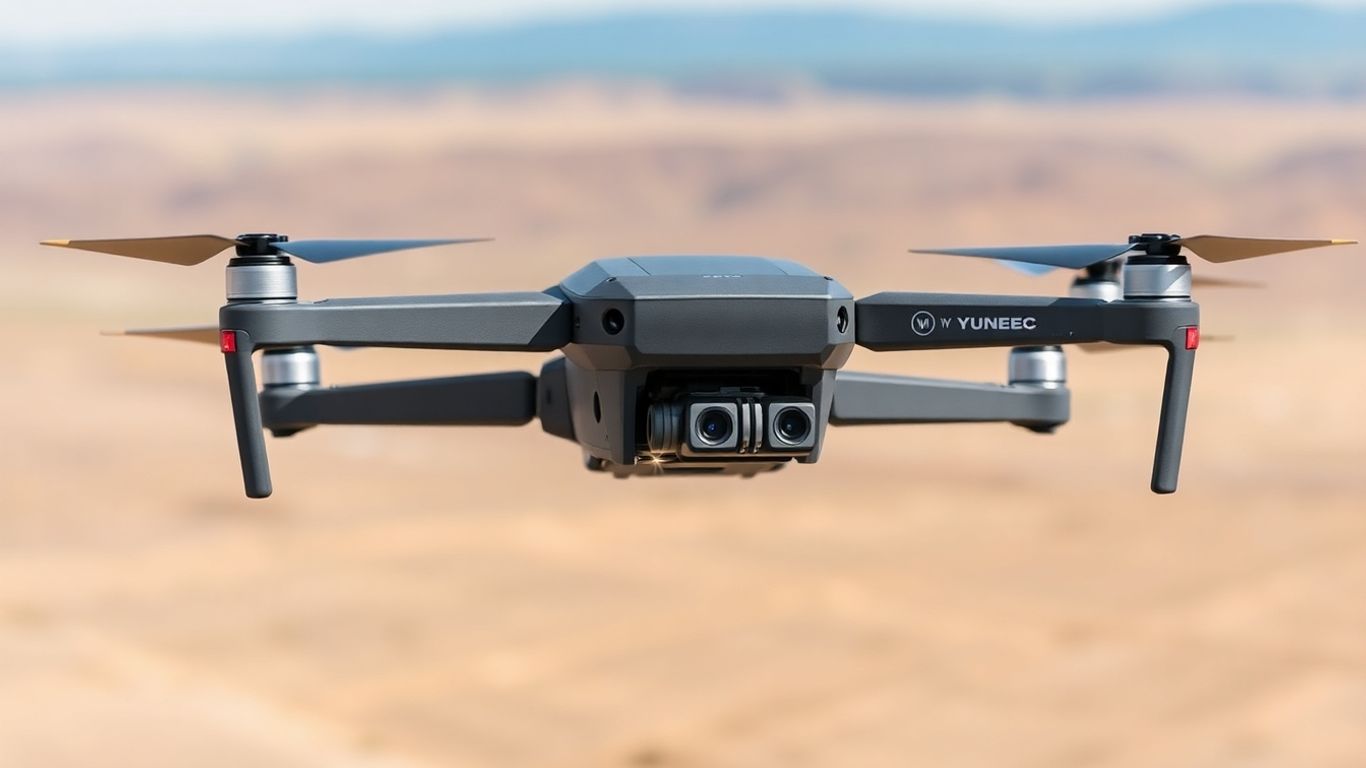
When you’re looking for a mapping drone that won’t break the bank, the Yuneec H520 RTK definitely pops up. It’s a pretty solid choice if you’re just getting into aerial surveying or if you’ve got a smaller operation. This hexacopter, meaning it has six rotors, comes with retractable landing gear, which is a nice touch for stability during flight.
One of the standout features is its interchangeable gimbal system. You can swap out different gimbals, which is handy if you have specific sensor needs for different jobs. The gimbal can spin a full 360 degrees, and the controller has a 7-inch screen, so you get a good look at what you’re mapping.
Here’s a quick rundown of what it offers:
- Accurate Positioning: It uses both GPS and GLONASS, so you can count on pretty precise location data.
- Flexible Gimbals: The ability to swap gimbals means you can adapt it to various tasks.
- Stable Flight: Retractable landing gear helps keep things steady.
- Good for Beginners: It’s a more affordable way to get into mapping.
However, it’s not all perfect. The camera is only 20MP, which is on the lower side compared to some other options out there. The transmission range is also a bit limited at 1.5km, meaning you can’t cover as much ground in one go. And the flight time is around 30 minutes per battery, so you’ll be swapping them out fairly often on larger projects. It also doesn’t have a lot of fancy autonomous flight modes.
While it might not have all the bells and whistles of the high-end models, the Yuneec H520 RTK provides a reliable and cost-effective entry point into professional mapping. Its core features are geared towards getting accurate data without an excessive investment.
Overall, the Yuneec H520 RTK is a decent option if budget is a major concern and you need a drone that can handle basic mapping tasks with reasonable accuracy.
10. Freefly Astro
The Freefly Astro is an American-made drone that really focuses on getting you super high-quality images. It’s built with a 61MP Sony Alpha 7R IVA camera, which is pretty serious for anyone needing really detailed outputs for photogrammetry. What’s cool is its modular design; you can swap out payloads pretty easily, making it adaptable for different jobs. This drone is a solid choice for specialized photogrammetry tasks where ultra-high-resolution is the main goal.
It’s designed to be efficient for mapping. You can get a lot done in a single flight, which is always a plus when you’re out in the field. For example, with the right setup, it can capture sub-centimeter orthomosaics and even generate cut-fill reports in about 25 minutes, using GPS for accuracy. It’s not the cheapest option out there, but if image quality is your top priority, it’s worth looking into.
Here’s a quick rundown of what makes it stand out:
- High-Resolution Payload: Features a 61MP Sony Alpha 7R IVA camera for exceptional detail.
- Modular Design: Allows for easy integration of different payloads, increasing versatility.
- Efficient Flight Times: Capable of completing mapping tasks quickly, like generating reports in under 30 minutes.
- Precision Data: Utilizes GPS for accurate data collection, important for surveying.
While the Astro is fantastic for image quality, it’s important to note that it doesn’t come with a LiDAR sensor. Also, its foam body, while lightweight, might not be the most durable option for really rough conditions. You’ll also need to plan your landing spots carefully, as hand launching can be a bit tricky if you’re not used to it.
If you’re looking for a drone that prioritizes image quality and offers flexibility for specialized photogrammetry, the Freefly Astro is definitely one to consider. It’s a step up for those who need that extra level of detail in their mapping projects.
Wrapping Up Your Drone Mapping Journey
So, we’ve looked at a bunch of drones that can really help with mapping and surveying. Picking the right one isn’t just about getting the fanciest gadget; it’s about finding a tool that fits what you need to do. Think about how big an area you’re covering, how precise you need to be, and what kind of data you’re collecting. Whether you’re working on a huge construction site or a small farm, there’s a drone out there that can make your job easier and give you better results. Don’t forget that the software you use to process the data is just as important as the drone itself. With the right drone and software combo, you’ll be collecting information faster and more accurately than ever before.
Frequently Asked Questions
What makes a drone good for mapping and surveying?
For mapping and surveying, drones need to be super accurate. This means they should have good GPS systems, like RTK, which helps them know their exact location down to the centimeter. Also, they need to fly for a good amount of time to cover large areas and carry cameras that take really clear, high-quality pictures or other special sensors like LiDAR. The drone’s ability to fly steadily and avoid obstacles is also important for getting good data without crashing.
How much do mapping drones usually cost?
Mapping drones can cost a lot, from a few thousand dollars for simpler models to tens of thousands for professional-grade ones. The price depends on things like how long they can fly, how good their camera is, if they have special features like RTK, and how tough they are built. Cheaper drones might be okay for small jobs, but for serious mapping, you’ll likely need to invest more.
What’s the difference between RTK and PPK for drones?
RTK, which stands for Real-Time Kinematic, helps the drone get super accurate location data while it’s flying by talking to a base station on the ground. PPK, or Post-Processed Kinematic, records the drone’s location data during flight and then uses that data later with ground station information to figure out the exact location. Both give very precise results, but RTK gives you the accuracy right away.
Do I need special software to use a mapping drone?
Yes, you definitely need special software. The drone’s camera takes lots of pictures, and mapping software puts them all together to create detailed maps and 3D models. Software like Pix4D, DroneDeploy, or Agisoft Metashape helps process all that image data and makes it usable for things like measuring land or checking construction sites.
How long does a typical drone mapping mission take?
A mapping mission can take anywhere from a few minutes to several hours, depending on the size of the area you need to map and how detailed you need the map to be. You also have to factor in the time it takes to plan the flight, set up the drone, and then process all the data afterward. Drones that can fly longer can cover bigger areas faster.
Can I use a regular drone for mapping?
While you can technically use a regular drone with a good camera to take aerial photos, it won’t be as accurate or efficient as a drone designed specifically for mapping and surveying. Mapping drones have features like RTK GPS for precision, better cameras for detailed imagery, and longer flight times. Regular drones usually lack these important tools for professional mapping work.